
Excavation.
Cubic yards from two scans.
How to work out excavation volume, truckloads and the pay line from two surveys and document it so the owner’s rep can check it, with a real ArchX result.
How do you calculate excavation volume from two drone scans?
From the difference between two ground surfaces, one before the dig and one after. Inside the pay line, usually the shoring or the excavation limit, the height difference of every grid cell or triangle is multiplied by its area and summed. That gives bank cubic yards; with the swell factor and the truck capacity you get loose cubic yards and truckloads.
What you need
Two surveys in the same coordinate system and vertical datum, for example drone point clouds as LAS files, the pay line, and a way to tell ground from equipment, stockpiles and vegetation.
Common mistakes
Most disputes over excavation quantities come from a few sources:
- The excavator in the pit counted as ground.
- A pay line that differs from the contract.
- Surveys in different coordinate systems or units (US survey feet against feet).
- Swell applied twice, or not at all.
How to do it.
- 01
Check the scans
Coordinate system, units, point density and coverage.
- 02
Filter ground
Remove equipment, stockpiles and vegetation.
- 03
Build surfaces
A grid or triangle network for each survey.
- 04
Compute the difference
Height difference times area inside the pay line.
- 05
Truckloads and report
Swell, truckloads, sections and a package the owner’s rep can recompute.
A real example: two drone scans of a building pit.
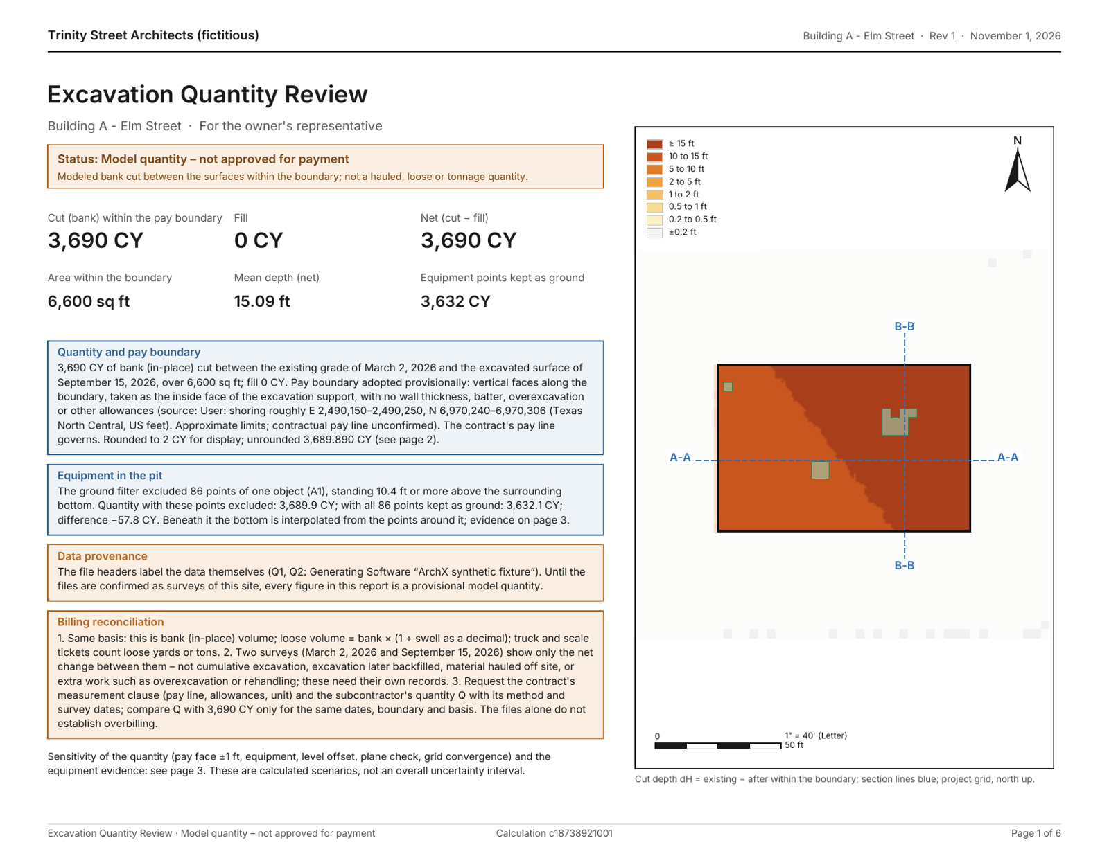
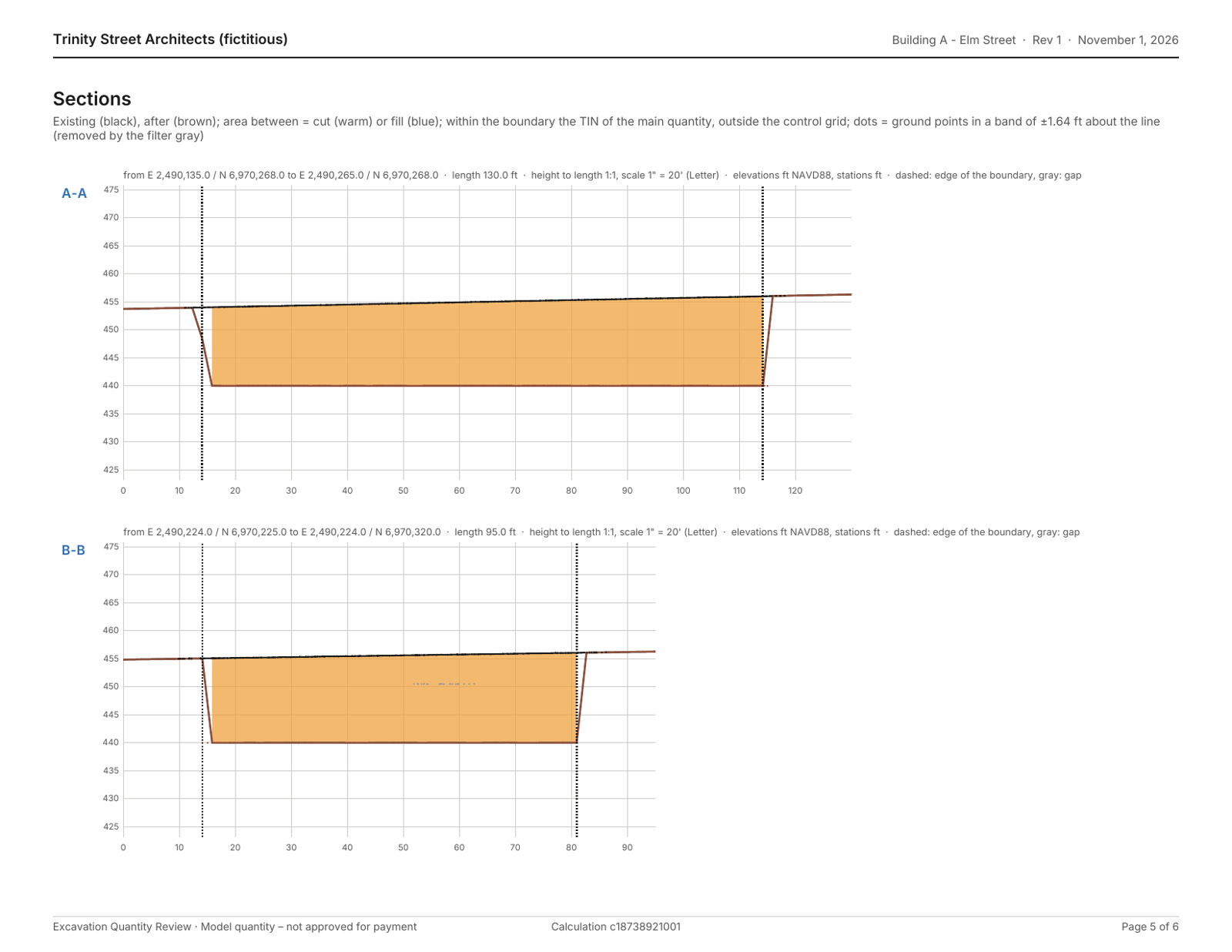
Two point clouds in the project folder, one request to ArchX: back came a report for the owner’s rep with the quantity, the pay line, sections, a workbook and a 3D view.
ArchX working time, measured
bank (in-place) excavation between the two drone scans
excavator points removed by the ground filter before computing the volume
Test project: Blind-test task 0.0.91: two synthetic drone point clouds (LAS header 'ArchX synthetic fixture') of a fictitious pit for 'Building A, Elm Street'; report issued as 'Trinity Street Architects (fictitious)'. See the full result
Asked briefly.
Bank or loose cubic yards?
The difference of the two surfaces gives bank cubic yards, as the material sat in the ground. Trucking and disposal count loose cubic yards: bank times the swell factor for the soil.
Can the owner’s rep check the figure?
Yes. ArchX adds the points, surfaces and a script that recomputes the quantity, so the figure can be checked independently.
Does it work with a design surface instead of a second scan?
Yes. ArchX also compares the design excavation against the existing survey, plan against as-built.
Try it on your own work.
Download ArchX for Mac or Windows and give it a task from your firm. 7 days free with your ChatGPT account (Plus or higher).